Strategic Land Use Plan (SLUP)
An Image-of-the-City Framework and Parcel Plan for Policy Guide and Investments in St. Louis, USA
December
2024
Cities
St.Louis, USA
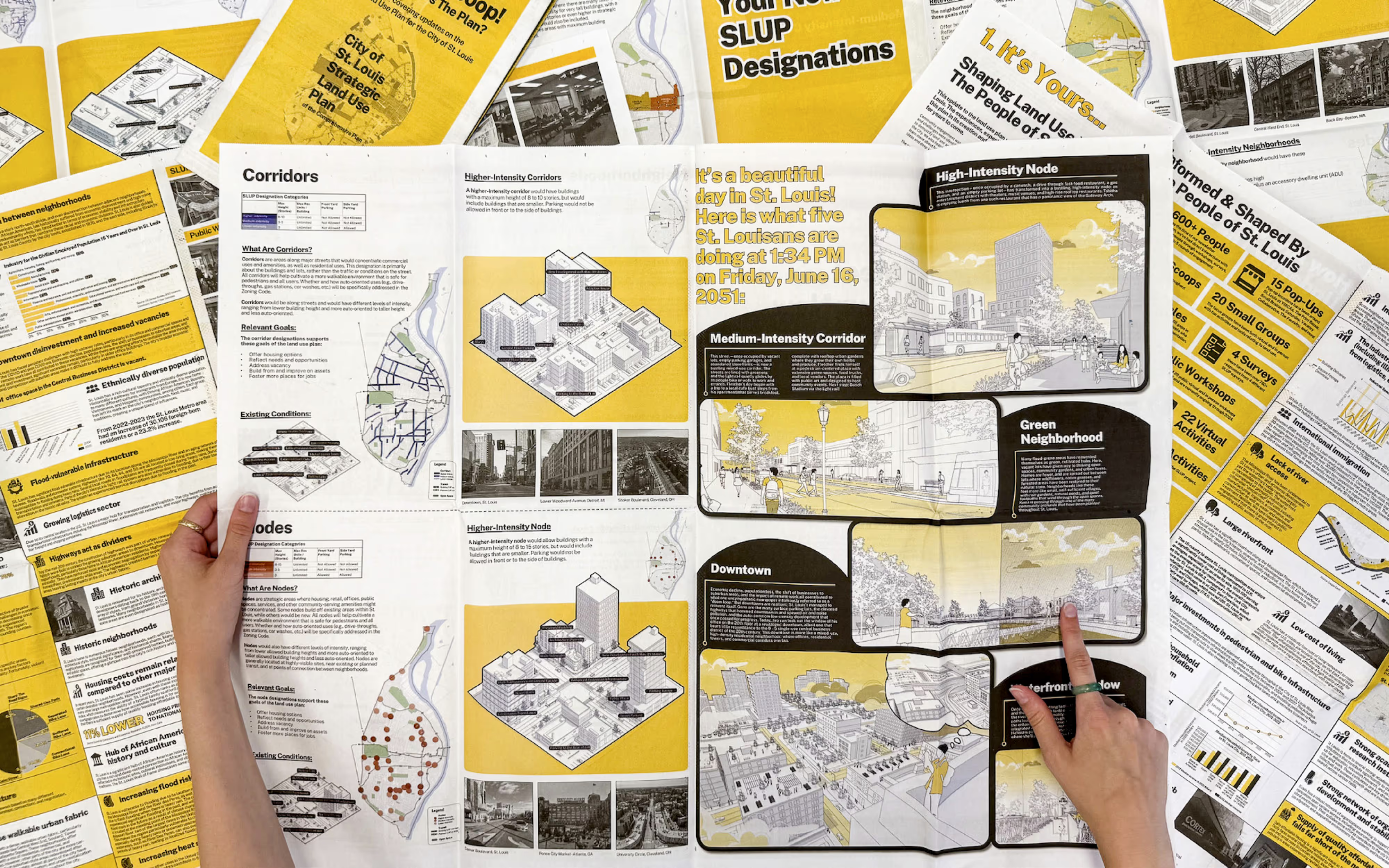
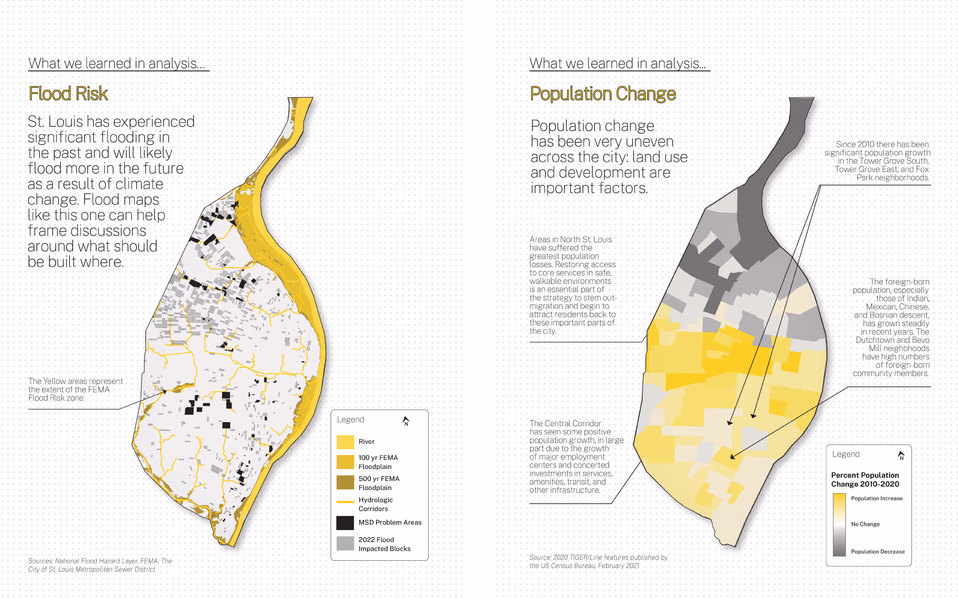
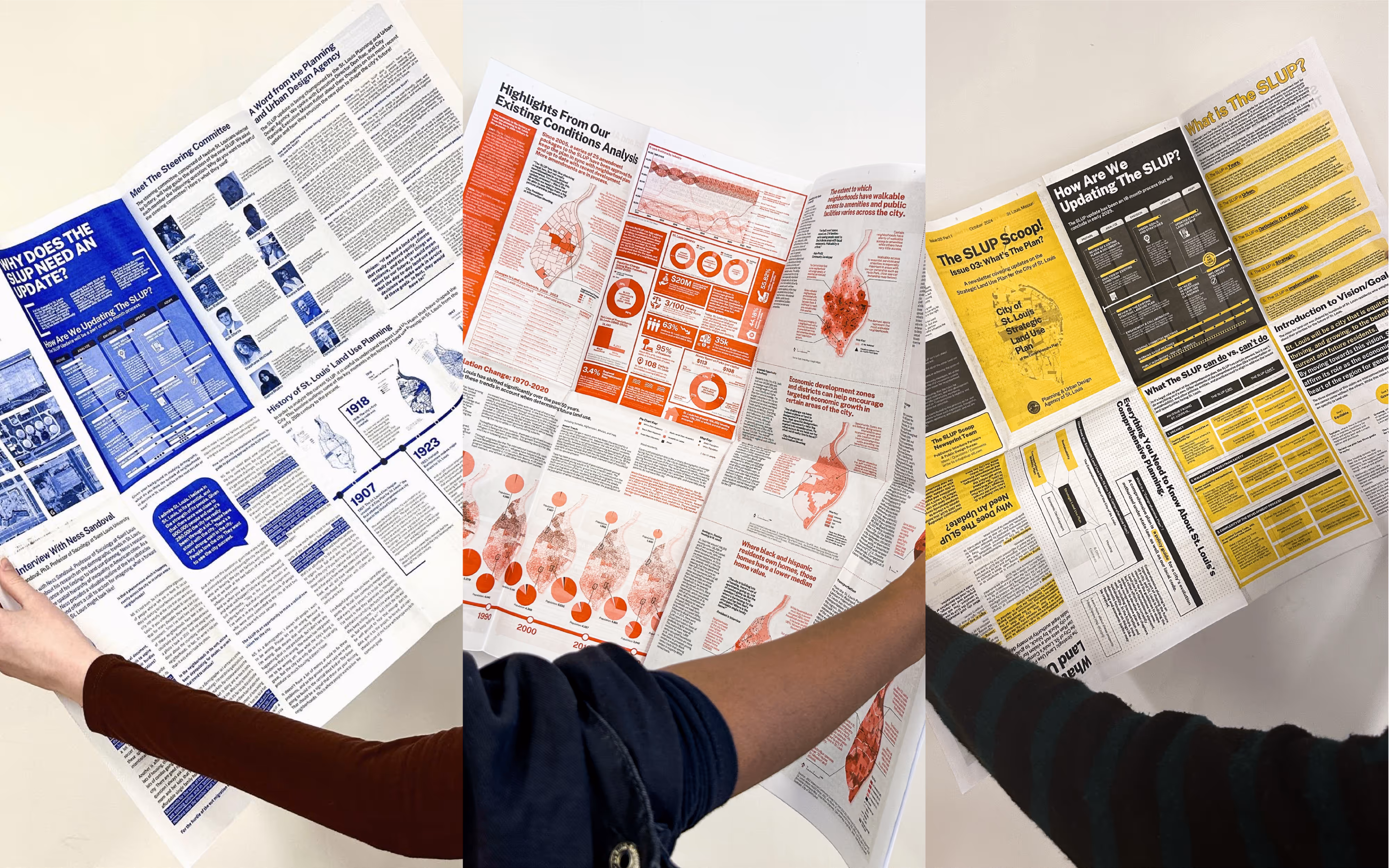
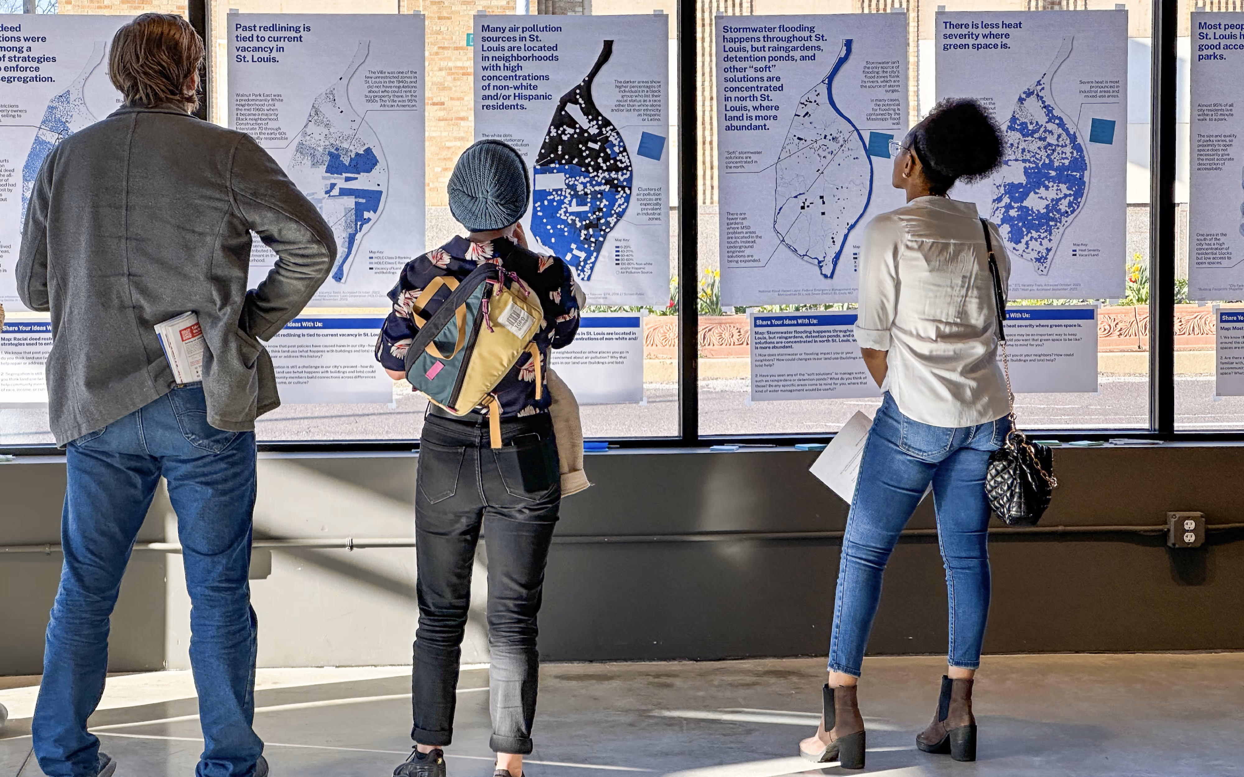
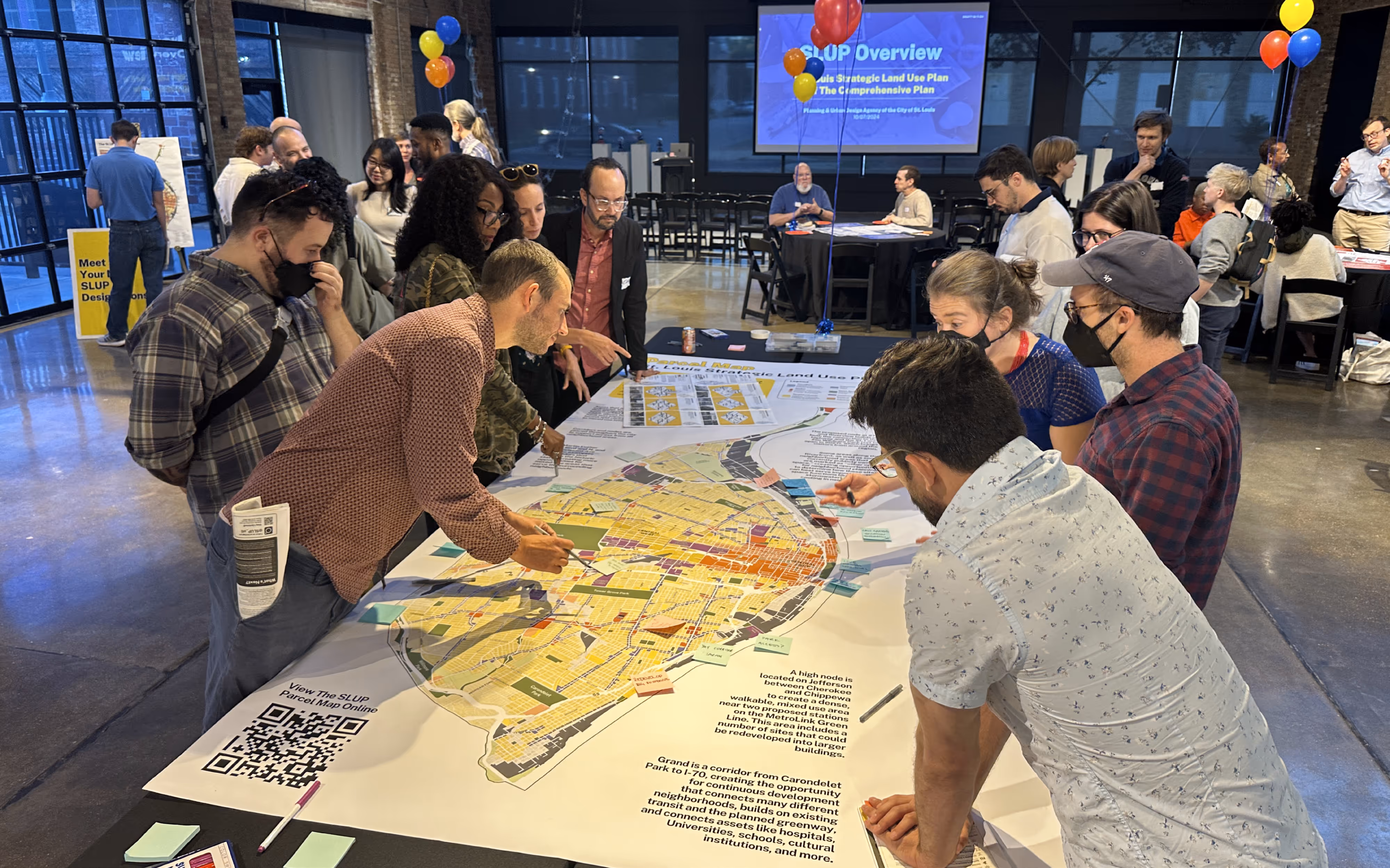
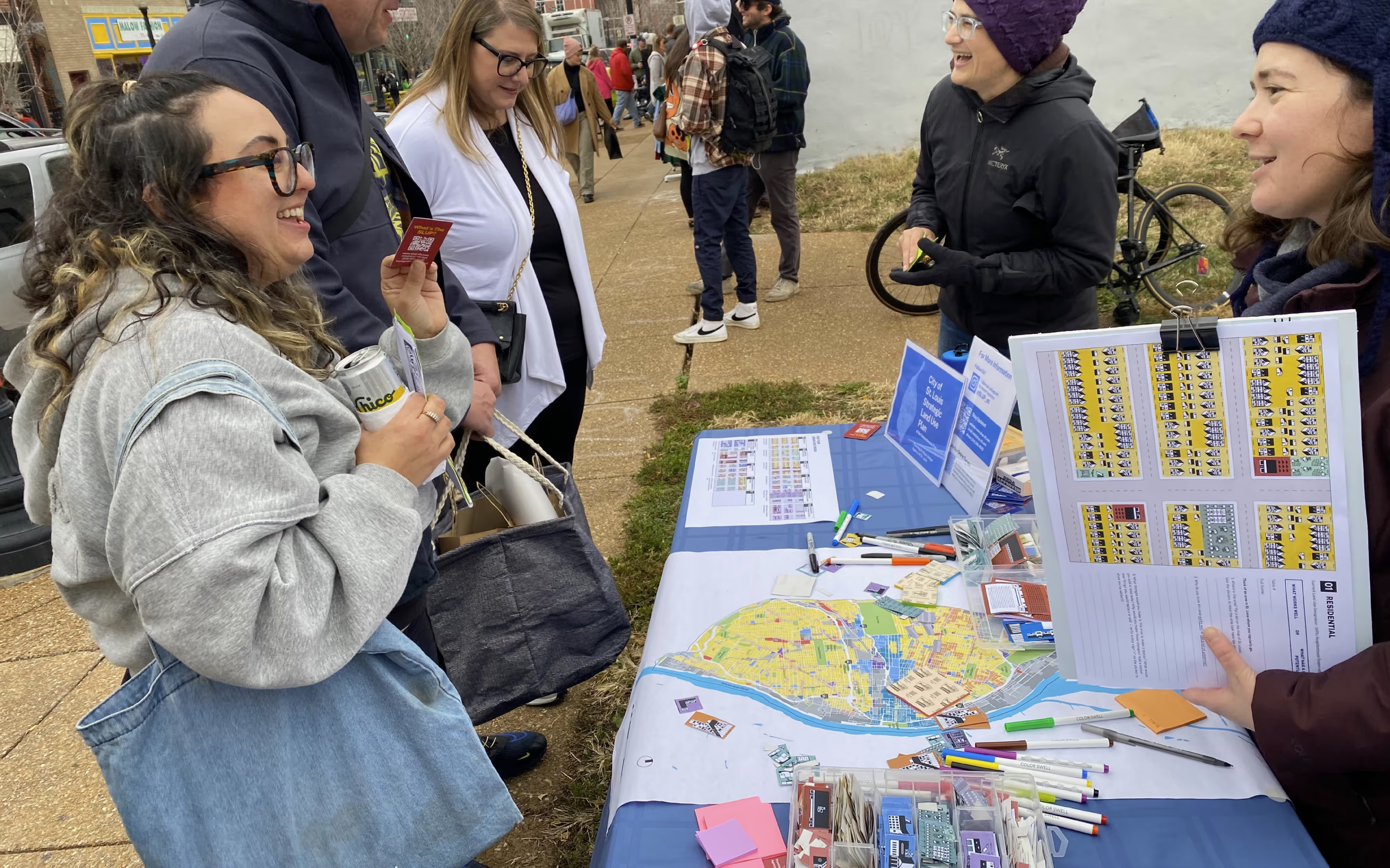
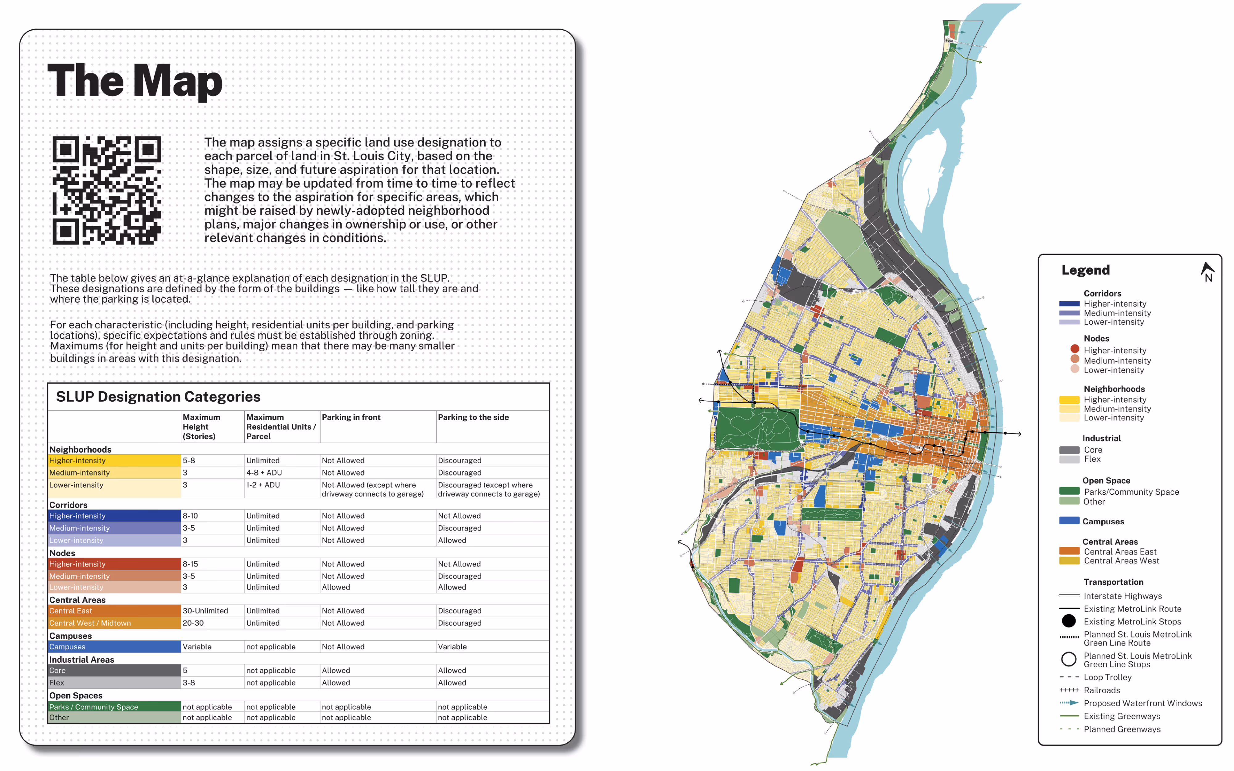
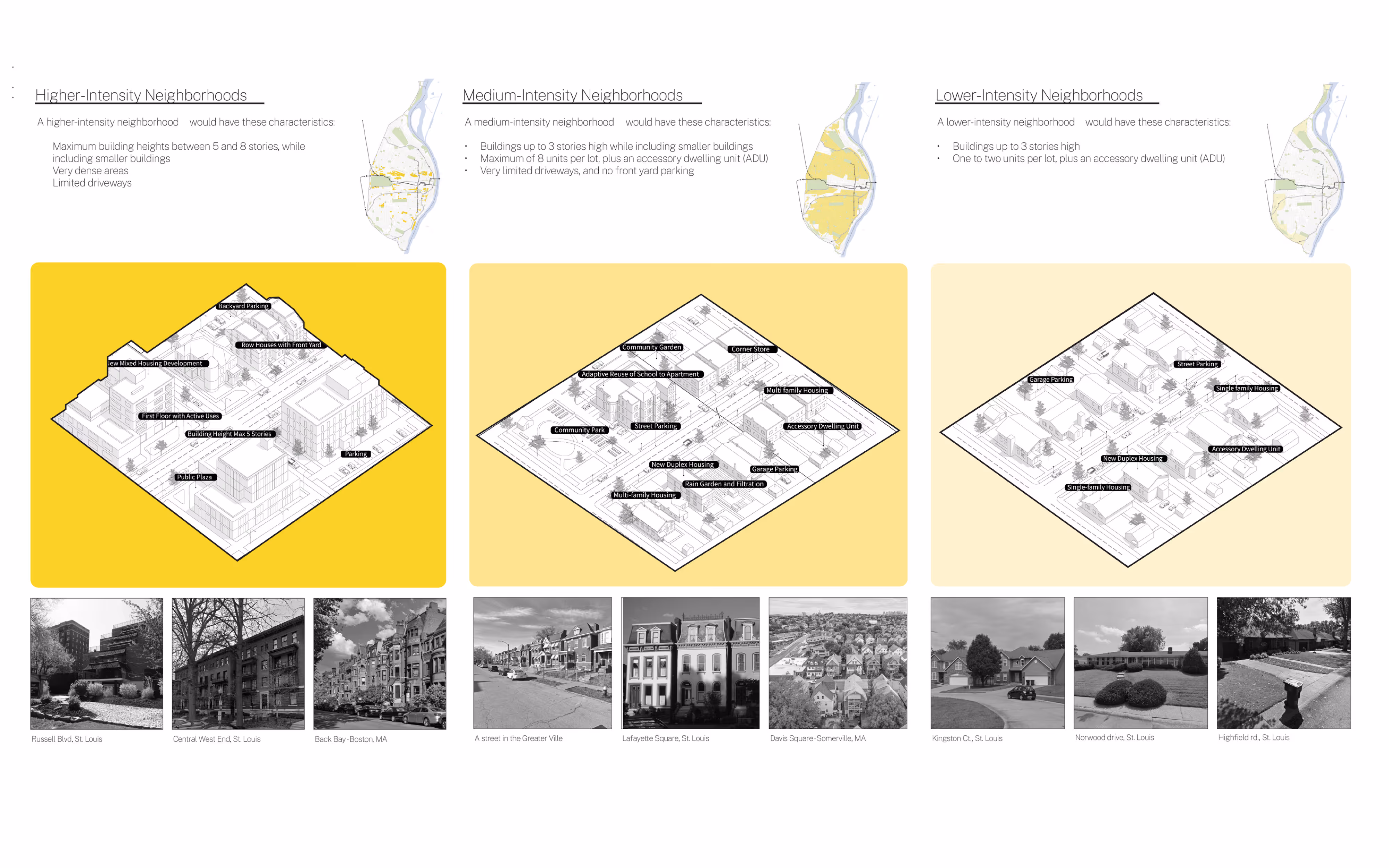
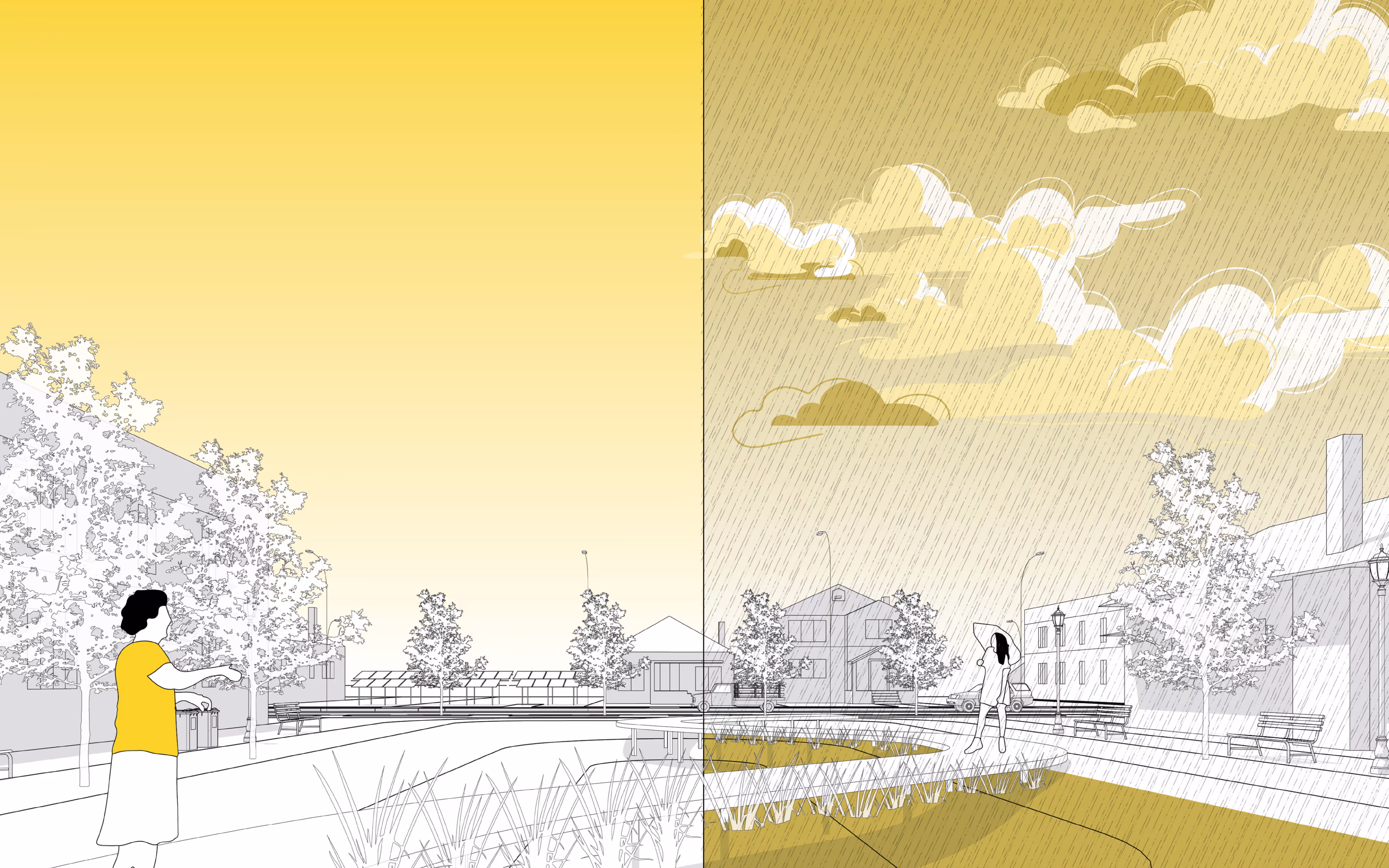
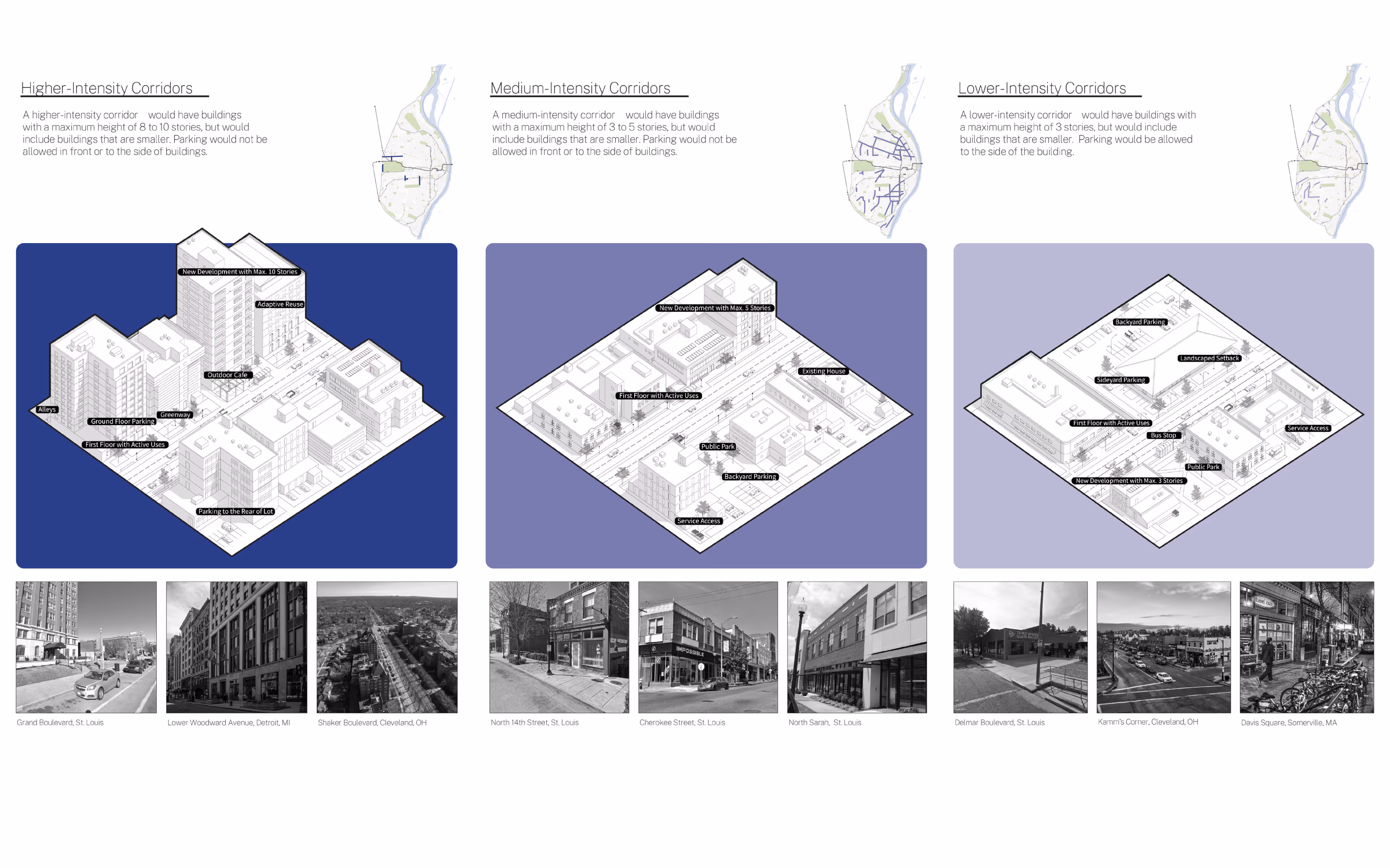
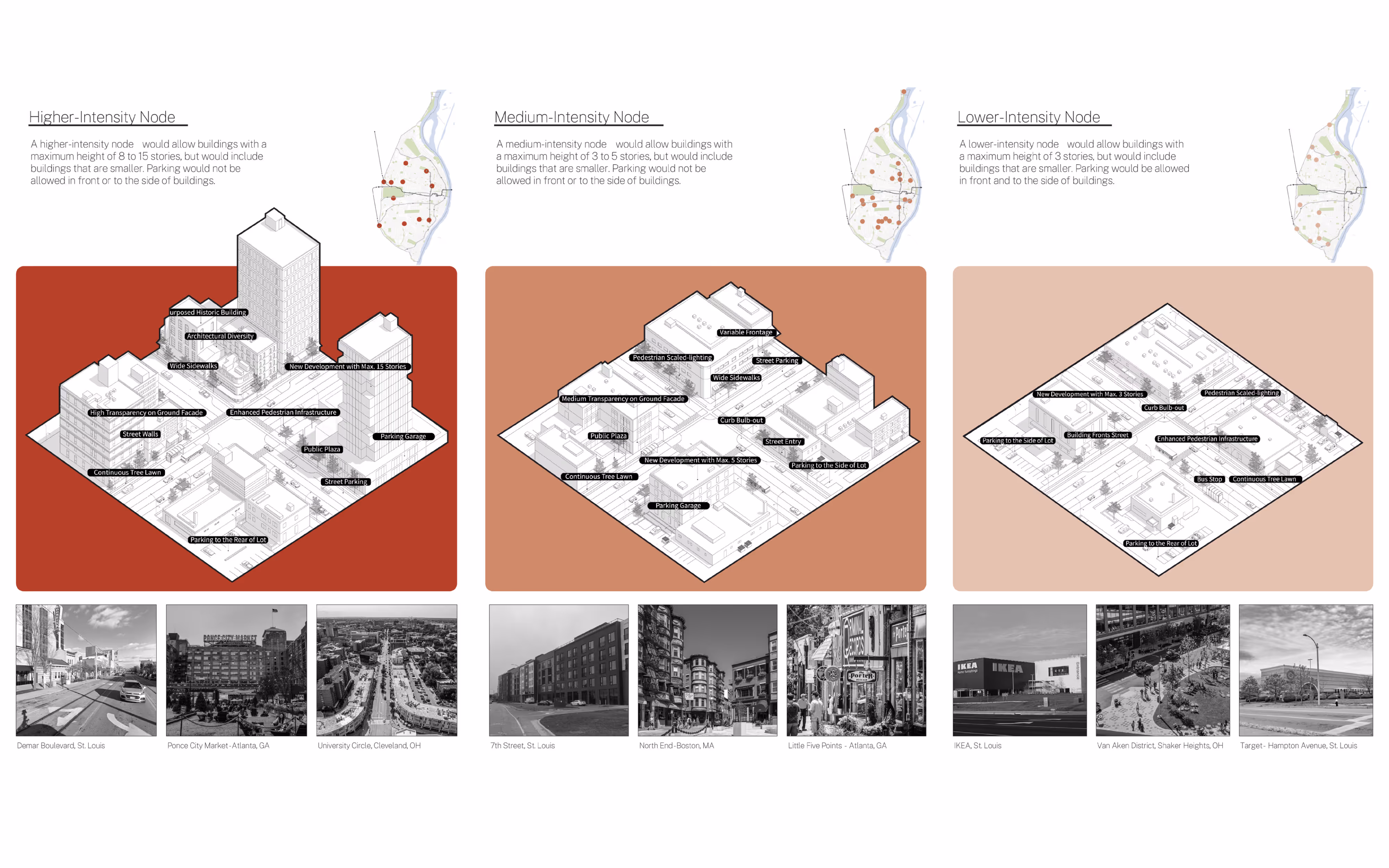
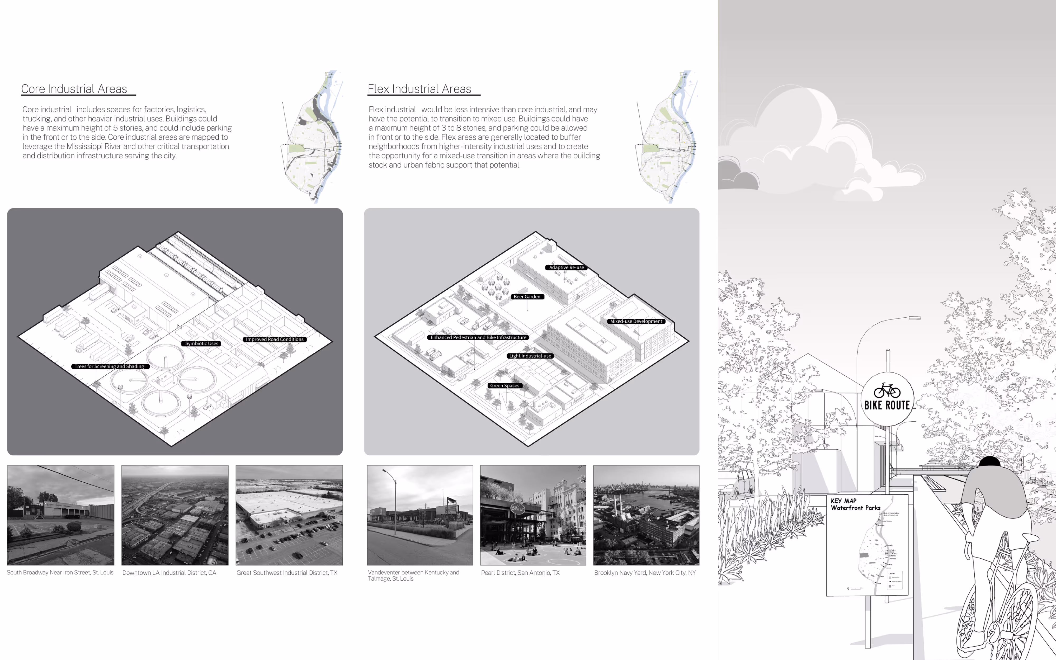
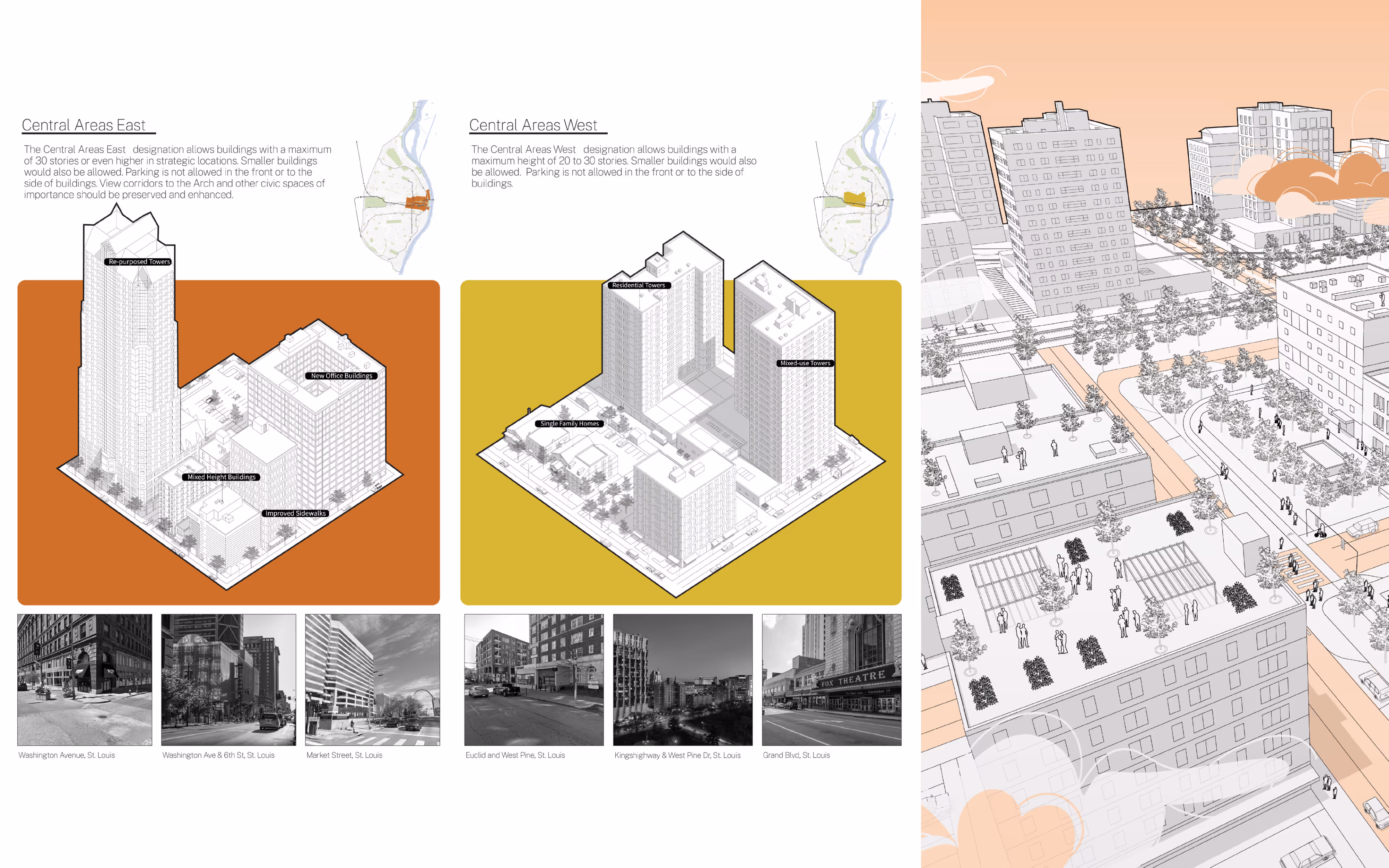
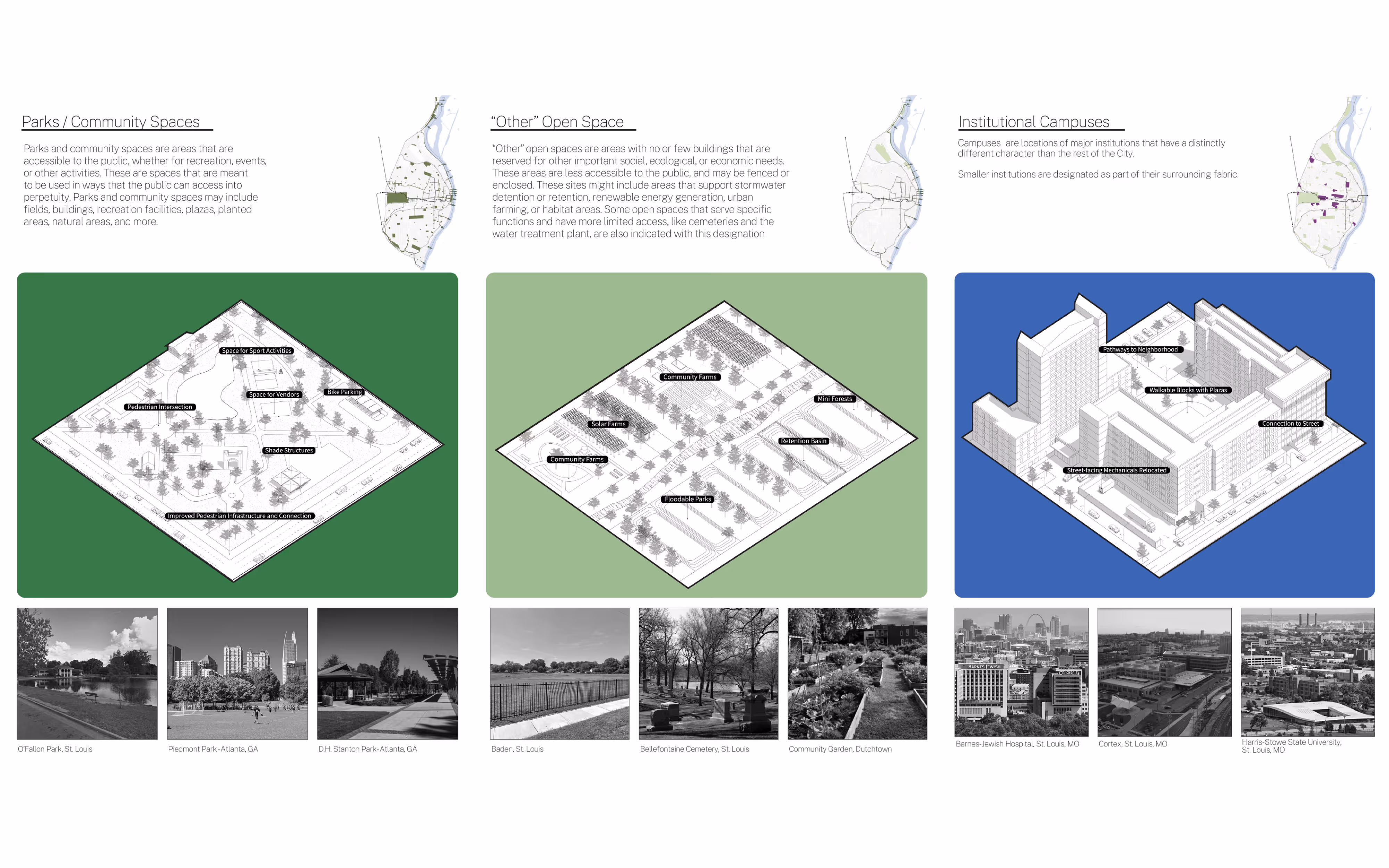
The 2005 Strategic Land Use Plan (SLUP) no longer addressed St. Louis’s contemporary challenges such as shifting demographics, persistent racial and spatial inequities rooted in historic redlining, rising climate risks such as Mississippi River flooding, and widespread vacancy. Without a coherent citywide vision, redevelopment, zoning reform, and equitable investment were hindered. To create the updated SLUP, we reviewed existing plans, conducted citywide geospatial analyses, and led a robust public engagement process involving more than 60 in-person activities, 32 public workshops, surveys, street pop-ups, games, newsletters, and walking tours, engaging over 1,700 residents. Guided by an “image of the city” framework and equity-focused strategies, the plan introduced new designation categories— like corridors, nodes, neighborhoods, and campuses—supported by parcel-level mapping and visualizations. Adopted in 2025 as part of the City’s Comprehensive Plan, the updated SLUP establishes the legal foundation for rezonings, redevelopment, and neighborhood planning that advance economic justice, climate resilience, and long-term sustainability.
Affliation
Interboro Partners