Transit Oriented Zoning Study
A Visioning Exercise for Zoning Codes Along a Proposed MetroLink Corridor in St. Louis, USA
May
2025
Cities
St.Louis, USA
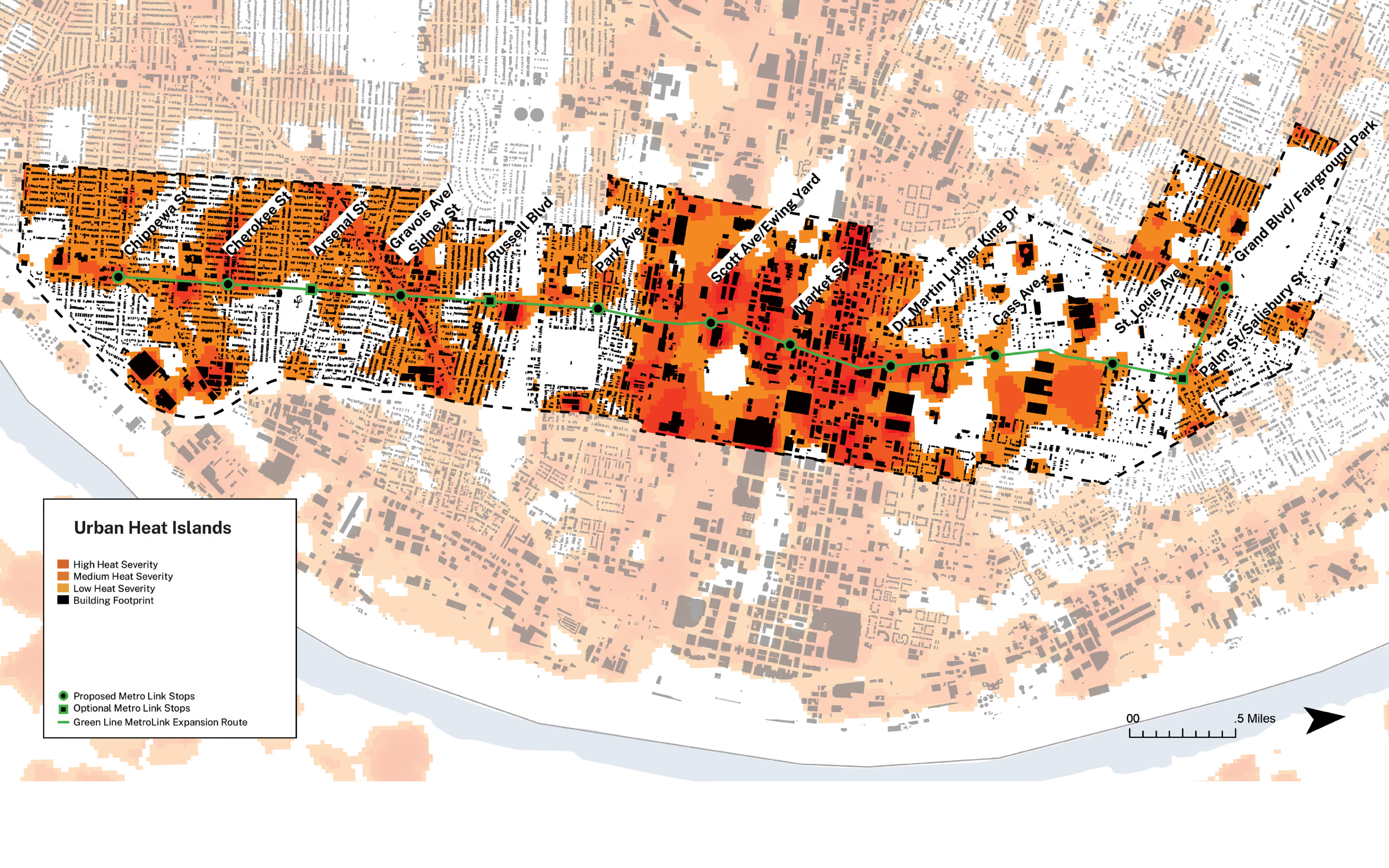
As part of a preliminary study for a citywide zoning overhaul and the proposed northside–southside MetroLink expansion (“Greenline”), the Planning and Urban Design Agency (PDA) of St. Louis engaged our team to conduct a transit-oriented zoning study for parcels along the corridor. The Greenline aims to strengthen connectivity, accessibility, and sustainable growth in northern neighborhoods facing chronic disinvestment and population decline. The study reviewed key planning documents intersecting with the corridor, analyzed form-based zoning precedents, and used geospatial mapping to assess vacancy, mobility, safety, amenity access, and climate risks. Guided by the 2025 Strategic Land Use Plan (SLUP), the proposed framework transitions to new zoning districts that emphasize building form and public space quality, remove density caps and parking minimums, limit auto-oriented uses, introduce a flexible industrial zone, and advance transit-oriented development. The study was presented through a corridor plan, sample district codes, and visualizations depicting life around future station areas.
Affliation
Interboro Partners