Data Stories
A Storytelling Approach Using Geospatial Visualizations of Data on Boston, USA
August
2021
Cities
Boston, USA
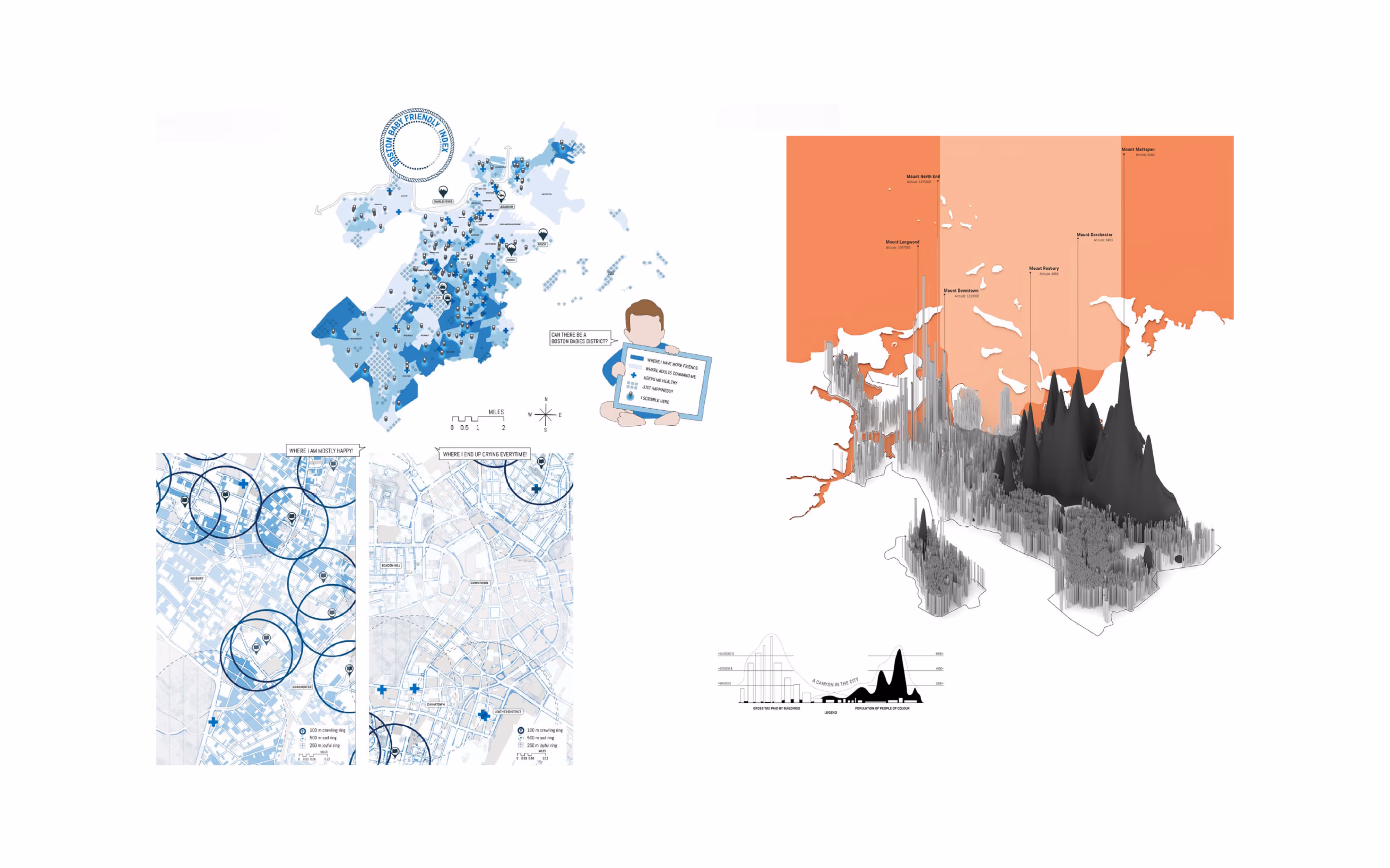
Cities are increasingly producing digital datasets that reveal hidden stories about urban life. This exercise examines two such stories in Boston—facilities for babies and patterns of racial disparity—through geospatial analysis, 3D modeling, and illustrative storytelling. By layering data and visualization, the project shows how overlooked or unevenly distributed resources shape everyday experiences, especially for groups often excluded from planning, such as infants and historically marginalized communities. The work demonstrates how playful yet critical mapping can surface insights about social infrastructure and urban justice.
Affliation
Harvard University Graduate School of Design